
Dates ........ MON SEPT 20, 1999
Miles ........ 21.7 miles
From ........ CT - KENT CT
To ............. NY - TELEPHONE PIONEERS SHELTER
Weather ... 40 degree morning, dew and mist , then sunny, hazy, warm, humid.
RESUPPLY went as planned at Kent. As soon as the post office opened I got my package, sorted the contents and sent back my extra stuff - exposed film, and map/guide/journal section of the trail completed (Mass pike to Kent CT - about 83 trail miles, plus side trips.) I ran into Soot - he was fresh and clean, having forked out over $100 for a room in a B&B. He was also getting mail and sporting a new pair of sneaks for the trail.
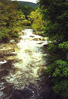
Breakfast of Ham and eggs at the diner, absolutely wonderful raspberry croissants at the bakery, eyeglass repair at the druggist and I hit the road, saying good by to Kent CT. Steeply up the hill to Mt. Algo, nice views over the trees back to Kent, across several streams still higher than usual, up onto Schaghticoke mountain, its rocky ledges and the Indian Reservation, then very steeply down into Bulls Bridge. There was a dam, hydro station and beautiful covered bridge over the now split and still raging Housatonic. The trail goes up on a high bank, popular with day hikers, until it comes to the junction with Ten Mile River, where I pose for a photo on the bridge. Then the AT climbs steeply up 10 mile Hill, crosses into NY at Hoyt Road. I met two other section hikers and three gals from Australia on the overlook.
At Wiley Shelter, Soot and I rest up then decide to push on 9.1 more miles to Telephone Pioneers shelter at 3:00 P.M. We had to hack and crawl, pulling our packs through behind us, through a terrible entanglement of MULTI-FLORA ROSE and blown down trees. We bled on that one. #(%^&-&*$@&^ brambles. Then we had to climb Hammersly Ridge, cross Pawling Nature Reserve, a neat old water tower, the AT Train Station and Tracks, farmland and cowfields, descend into a valley and cross a swamp before climbing 400 feet up Corbin Hill, descending into another valley then climb 600 feet of near vertical solid rock up West Mountain IN THE DARK to reach the shelter at 7:45 P.M.. Another through hiker joined us after dark. Very tired, we got water, cooked dinner. I bathed, then turned in.
|
Sun
|
Mon
|
Tue
|
Wed
|
Thur
|
Fri
|
Sat
|
| 09/22/99 | 09/24/99 | 09/25/99 | ||||